Maps of all countries are available for everyone to view. These usually contain detailed information about the physical features of each country, such as mountains and rivers, as well as statistics regarding the population, economics, and other aspects.
In addition to this, they may also provide useful historical information. Maps of all countries include the political boundaries of each country, as well as the name of the president, prime minister, and other government officials. However, if you don’t feel comfortable looking up the names of all these different countries, you can always look for other resources online.
There are many different types of maps there like a political world map etc. Maps of all countries are excellent for students who study the world. These maps include the names of every country, their capitals, and their areas of influence.
You can also look at a list of all nations by continent and the area in which it is located. Maps of all countries information are essential for students who want to learn about a particular country’s location.
Maps of all countries in the world
One of the best sources for learning about countries is the Internet. Many websites and libraries feature maps of all countries, and you can find information about every country from around the world.
| S/No | Country Name | Map |
|---|---|---|
| 1 | Afghanistan | 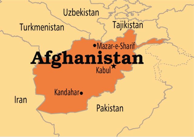 |
| 2 | Albania | 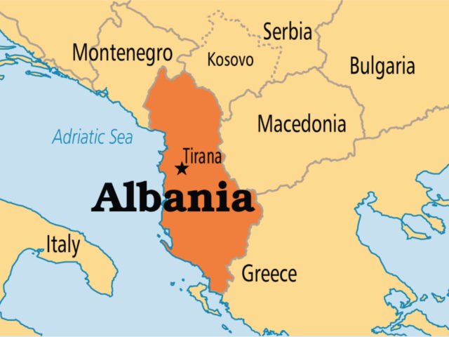 |
| 3 | Algeria | 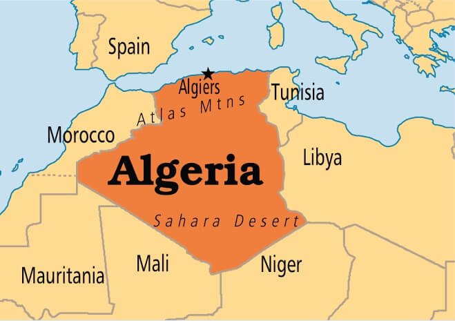 |
| 4 | Andorra |  |
| 5 | Angola | 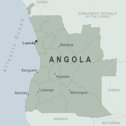 |
| 6 | Antigua & Barbuda | 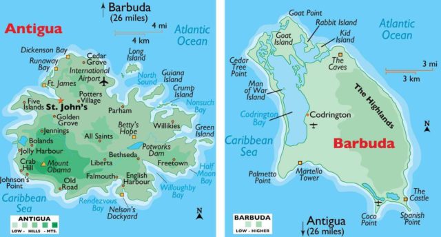 |
| 7 | Argentina | 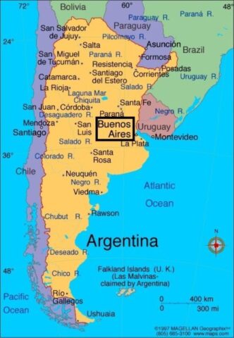 |
| 8 | Armenia | 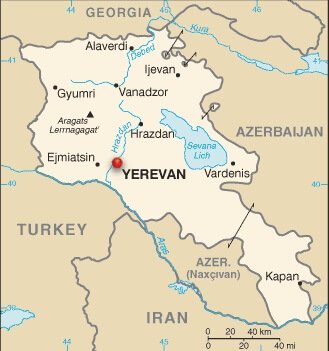 |
| 9 | Australia | 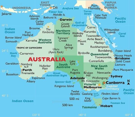 |
| 10 | Austria | 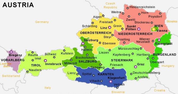 |
| 11 | Azerbaijan | 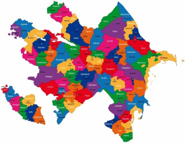 |
| 12 | Bahrain | 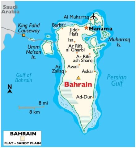 |
| 13 | Bangladesh | 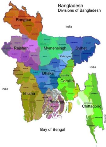 |
| 14 | Barbados | 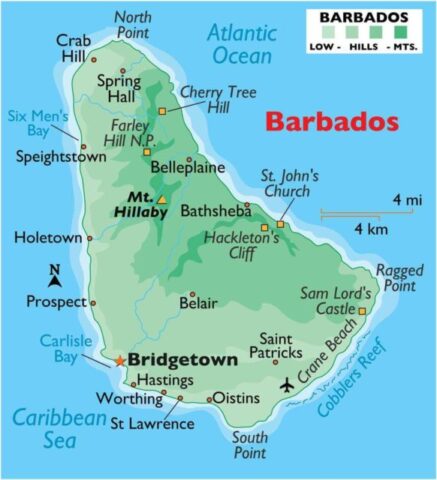 |
| 15 | Belarus | 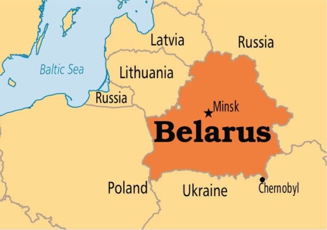 |
| 16 | Belgium | 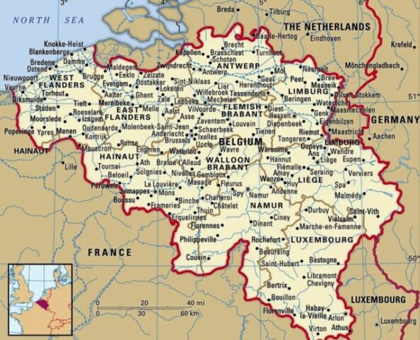 |
| 17 | Belize | 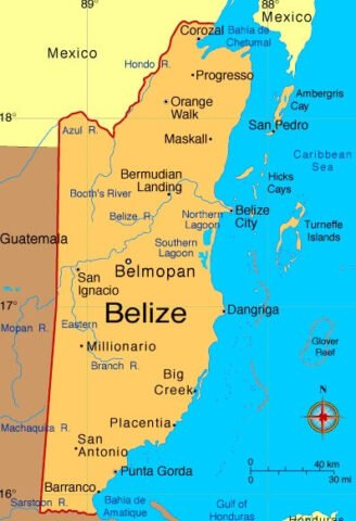 |
| 18 | Benin | 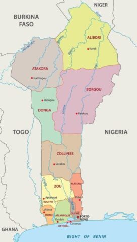 |
| 19 | Bhutan | 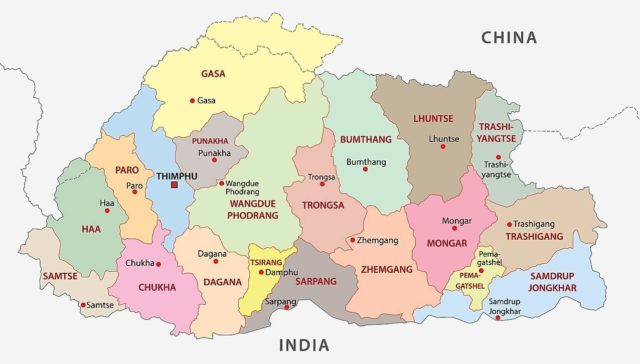 |
| 20 | Bolivia | 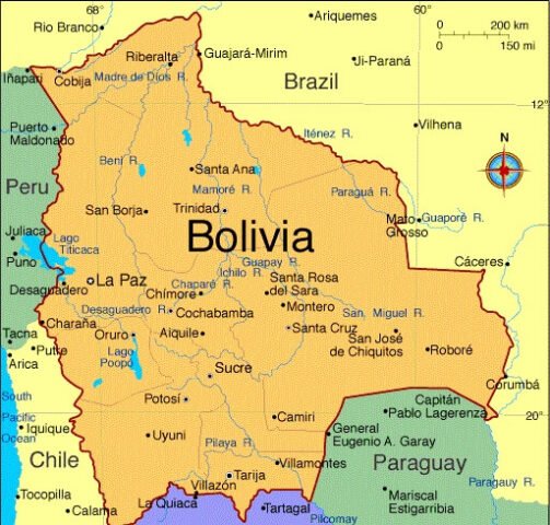 |
| 21 | Bosnia & Herzegovina | 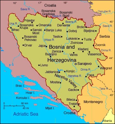 |
| 22 | Botswana | 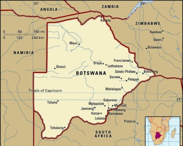 |
| 23 | Brazil | 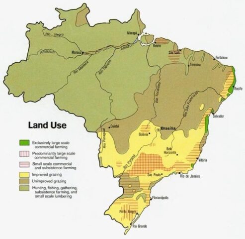 |
| 24 | Brunei | 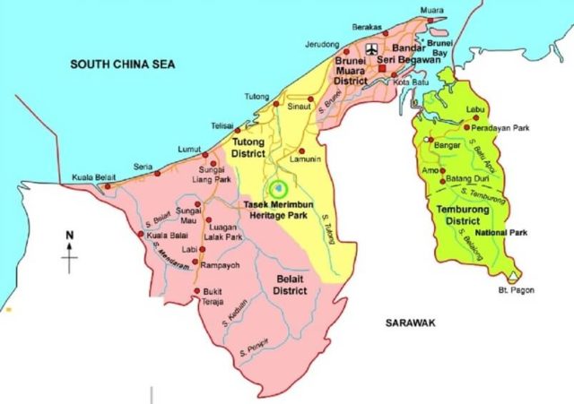 |
| 25 | Bulgaria | 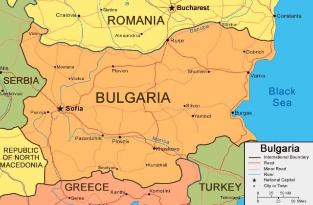 |
| 26 | Burkina Faso | 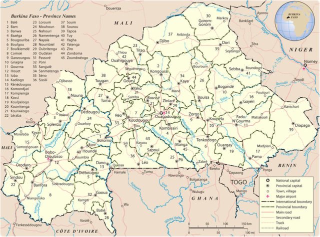 |
| 27 | Burundi | 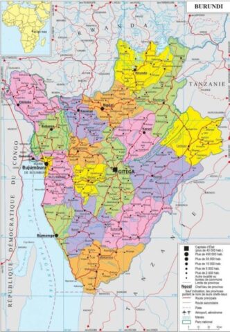 |
| 28 | Cambodia | 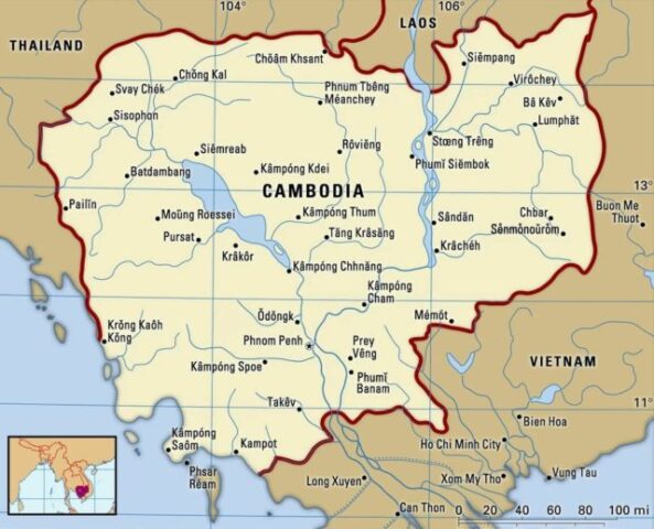 |
| 29 | Cameroon | 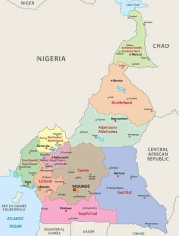 |
| 30 | Canada | 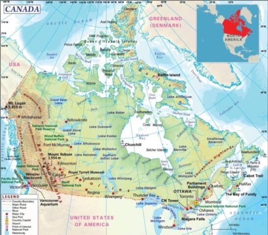 |
| 31 | Cape Verde | 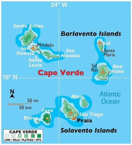 |
| 32 | Central African Republic | 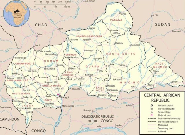 |
| 33 | Chad | 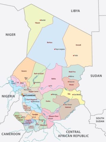 |
| 34 | Chile | 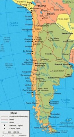 |
| 35 | China | 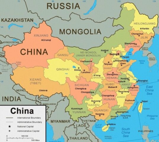 |
| 36 | Colombia | 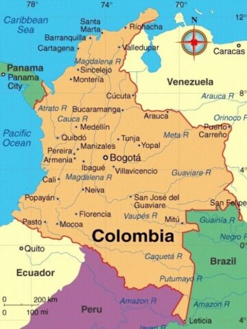 |
| 37 | Comoros | 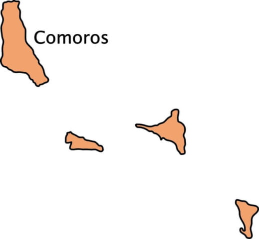 |
| 38 | Costa Rica | 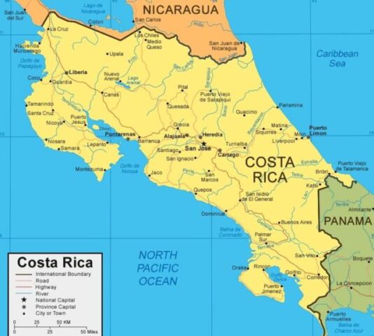 |
| 39 | Cote d’Ivoire (Ivory Coast) | 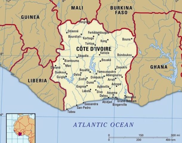 |
| 40 | Croatia | 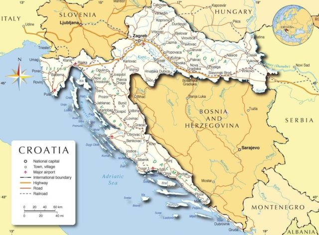 |
| 41 | Cuba | 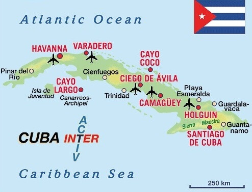 |
| 42 | Cyprus | 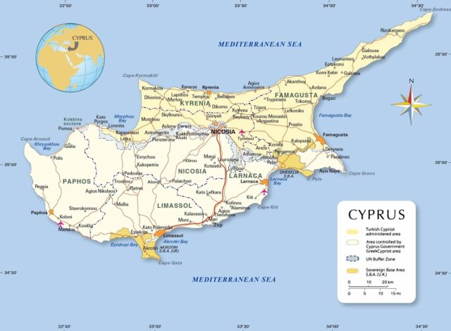 |
| 43 | Czech Republic | 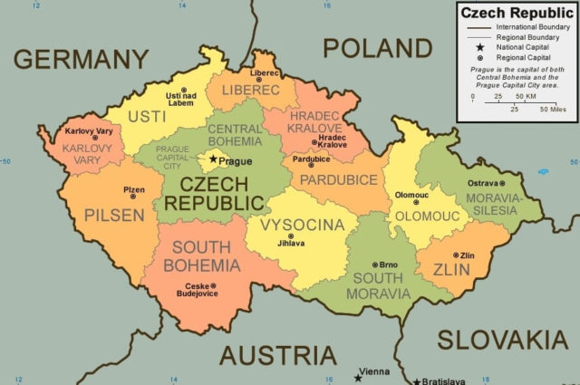 |
| 44 | Denmark |  |
| 45 | Djibouti | 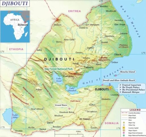 |
| 46 | Dominica | 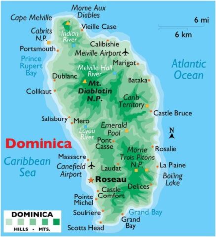 |
| 47 | Dominican Republic | 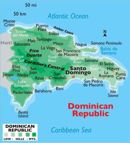 |
| 48 | Ecuador | 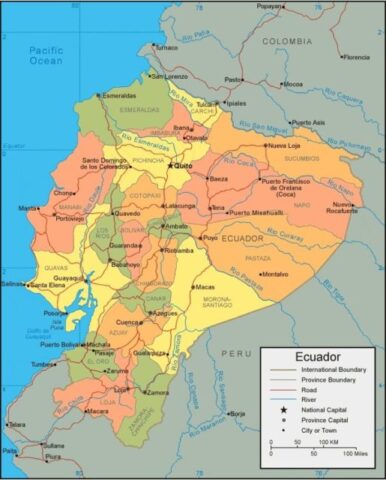 |
| 49 | Egypt | 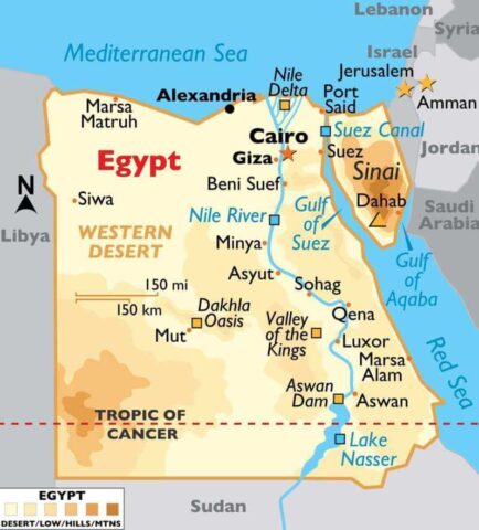 |
| 50 | El Salvador | 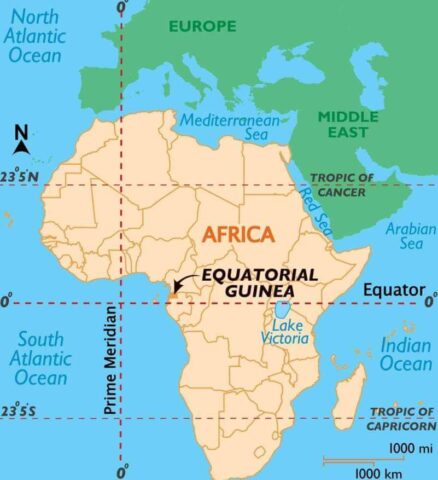 |
| 51 | Equatorial Guinea |  |
| 52 | Eritrea | 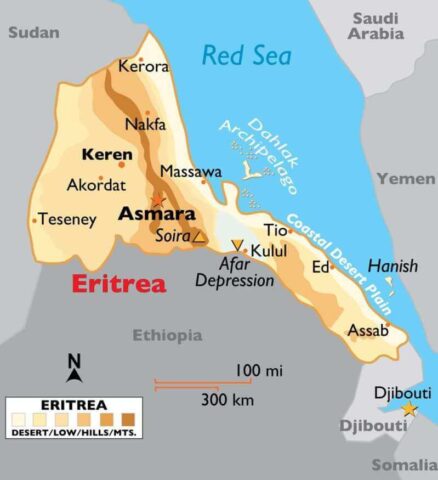 |
| 53 | Estonia | 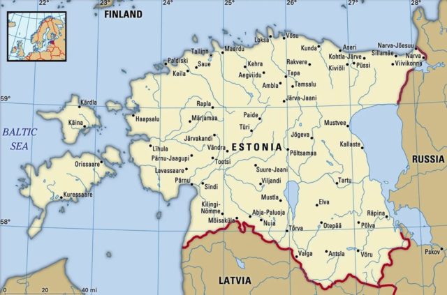 |
| 54 | Ethiopia | 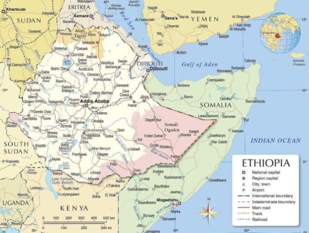 |
| 55 | Federated States of Micronesia | 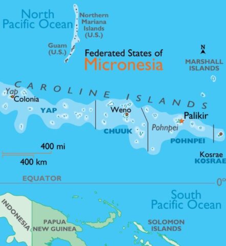 |
| 56 | Fiji | 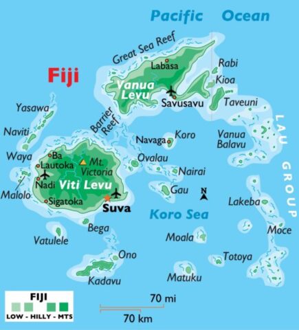 |
| 57 | Finland | 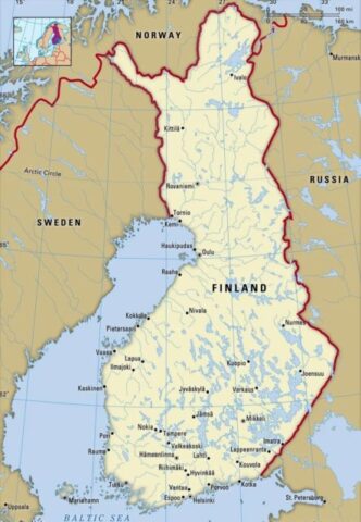 |
| 58 | France | 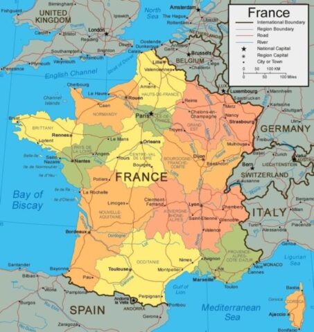 |
| 59 | Gabon | 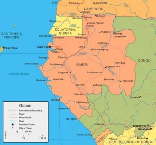 |
| 60 | Georgia | 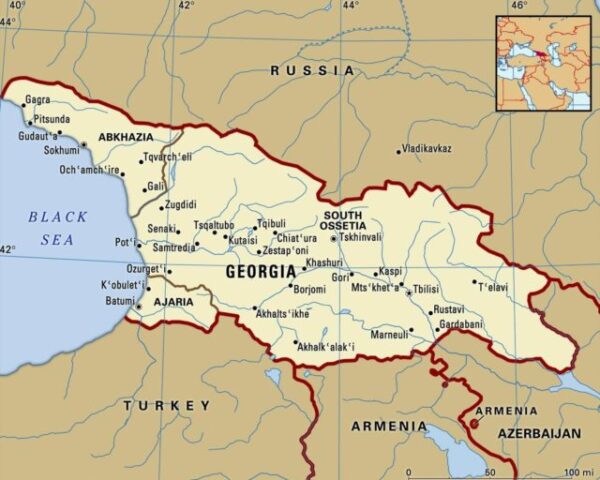 |
| 61 | Germany | 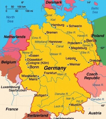 |
| 62 | Ghana | 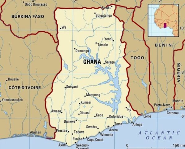 |
| 63 | Greece | 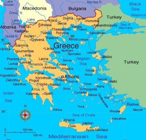 |
| 64 | Grenada | 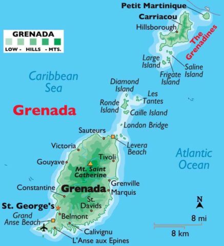 |
| 65 | Guatemala | 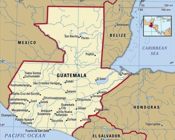 |
| 66 | Guinea | 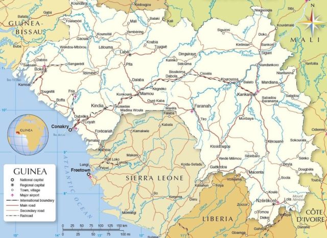 |
| 67 | Guinea Bissau | 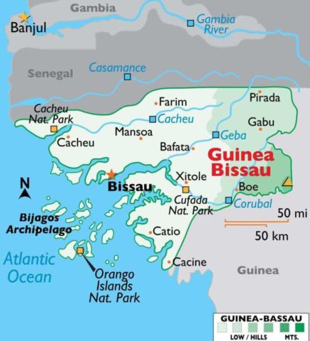 |
| 68 | Guyana | 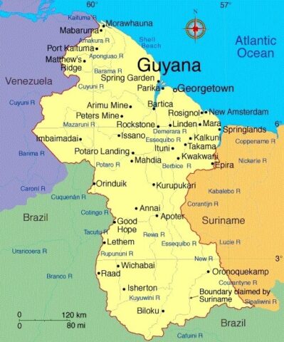 |
| 69 | Haiti | 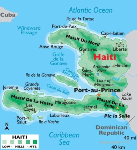 |
| 70 | Honduras | 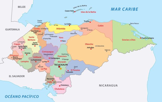 |
| 71 | Hungary | 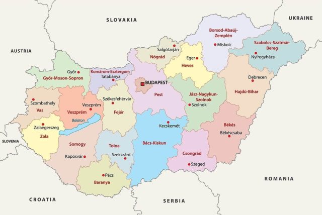 |
| 72 | Iceland | 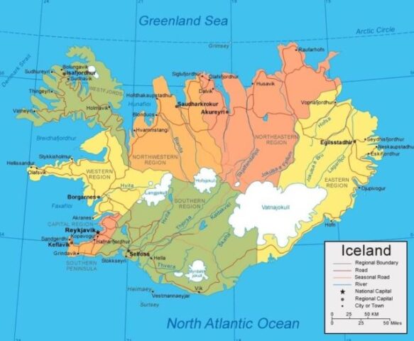 |
| 73 | India | 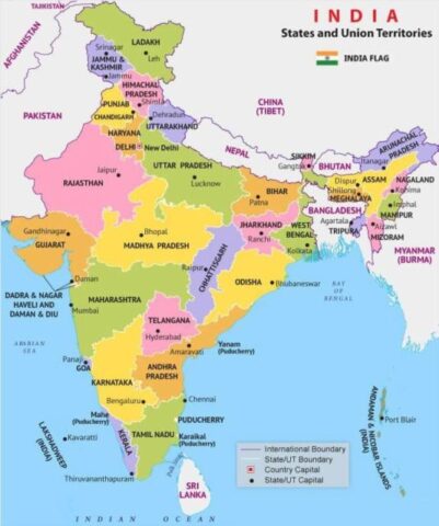 |
| 74 | Indonesia | 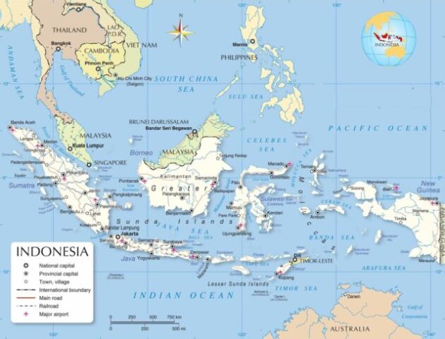 |
| 75 | Iran | 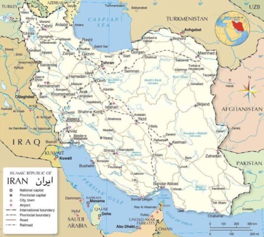 |
| 76 | Iraq | 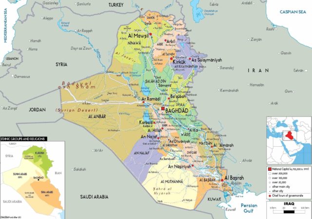 |
| 77 | Ireland | 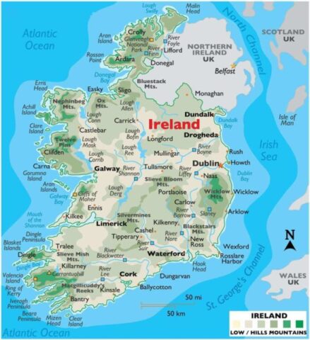 |
| 78 | Israel | 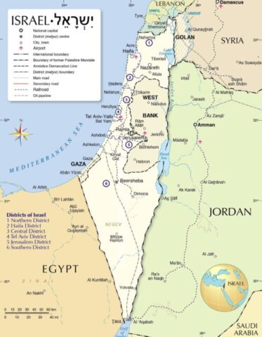 |
| 79 | Italy | 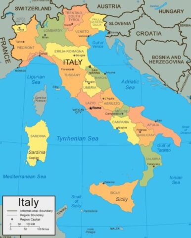 |
| 80 | Jamaica | 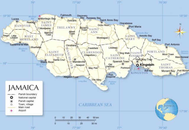 |
| 81 | Japan | 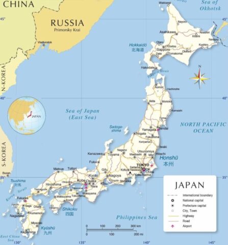 |
| 82 | Jordan | 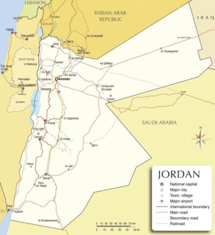 |
| 83 | Kazakhstan | 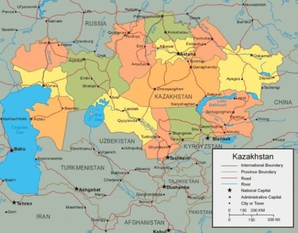 |
| 84 | Kenya | 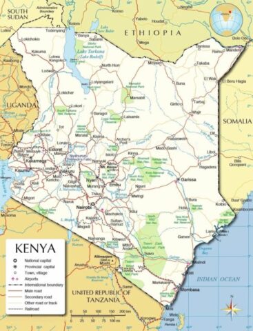 |
| 85 | Kiribati | 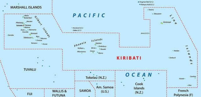 |
| 86 | Kuwait | 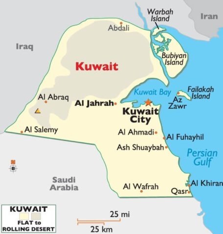 |
| 87 | Kyrgyzstan | 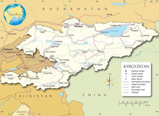 |
| 88 | Laos | 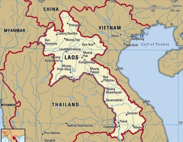 |
| 89 | Latvia |  |
| 90 | Lebanon | 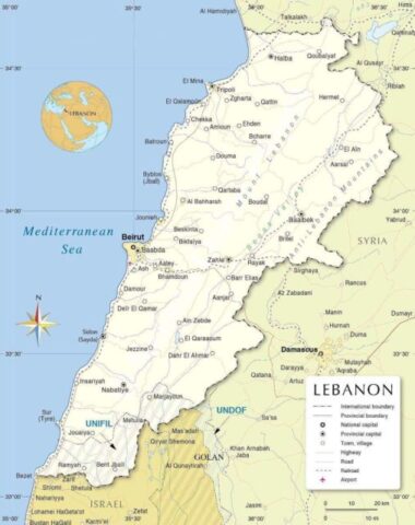 |
| 91 | Lesotho | 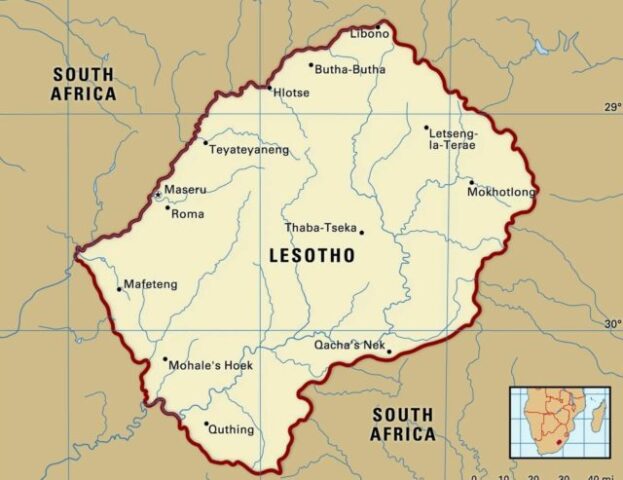 |
| 92 | Liberia | 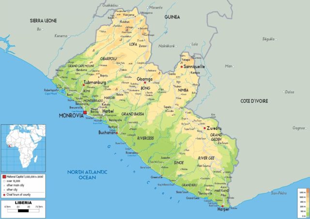 |
| 93 | Libya | 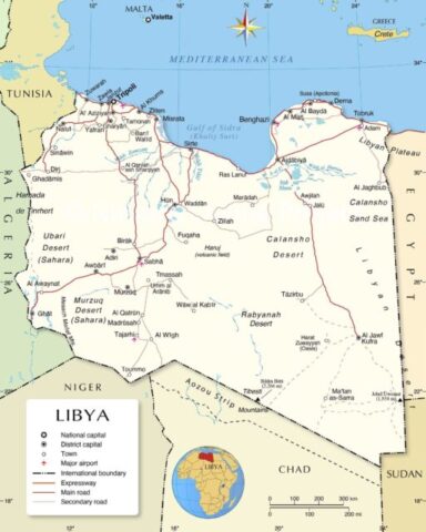 |
| 94 | Liechtenstein | 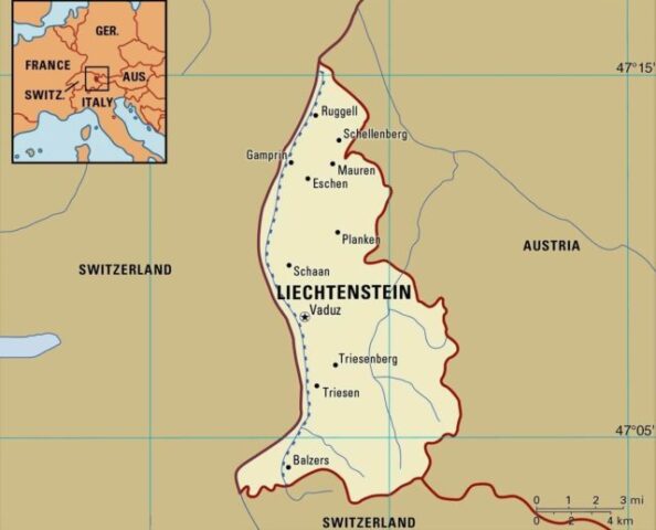 |
| 95 | Lithuania | 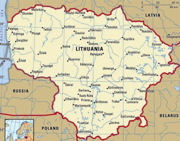 |
| 96 | Luxembourg | 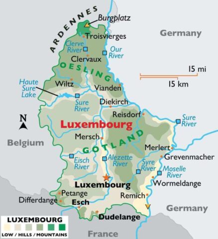 |
| 97 | Macedonia |  |
| 98 | Madagascar | 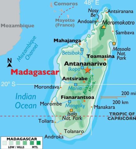 |
| 99 | Malawi | 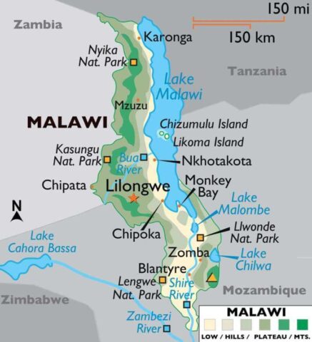 |
| 100 | Malaysia | 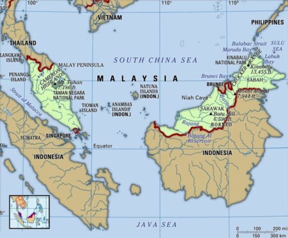 |
| 101 | Maldives | 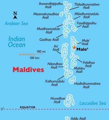 |
| 102 | Mali | 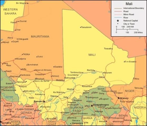 |
| 103 | Malta | 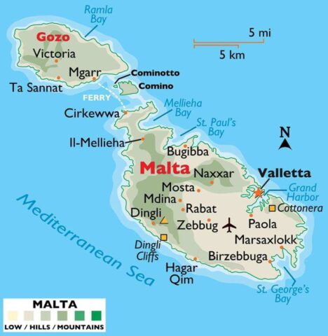 |
| 104 | Marshall Islands | 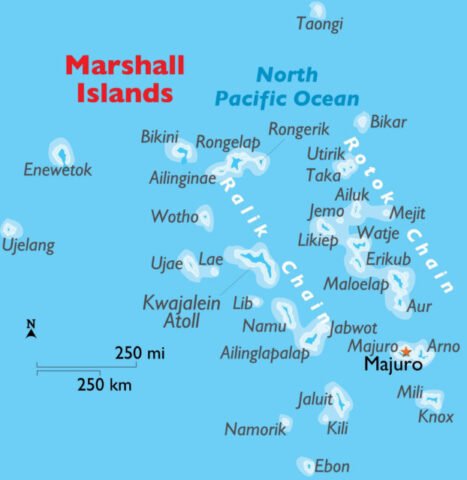 |
| 105 | Mauritania | 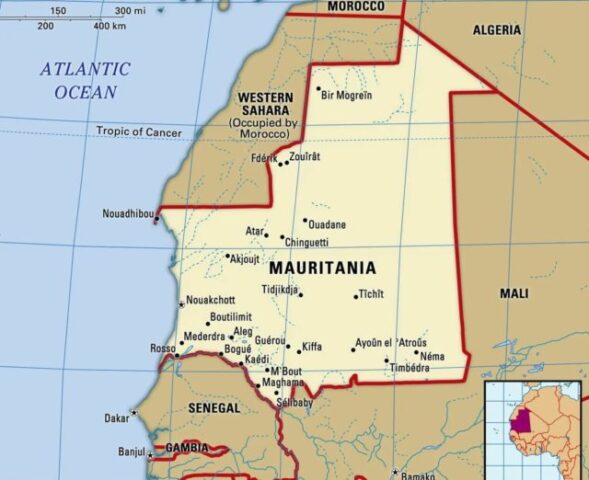 |
| 106 | Mauritius | 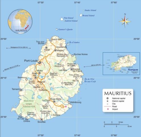 |
| 107 | Mexico | 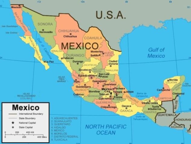 |
| 108 | Moldova | 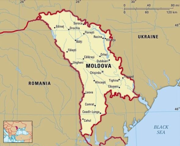 |
| 109 | Monaco | 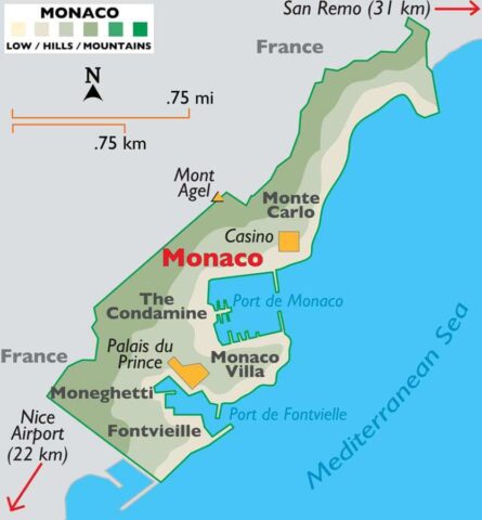 |
| 110 | Mongolia | 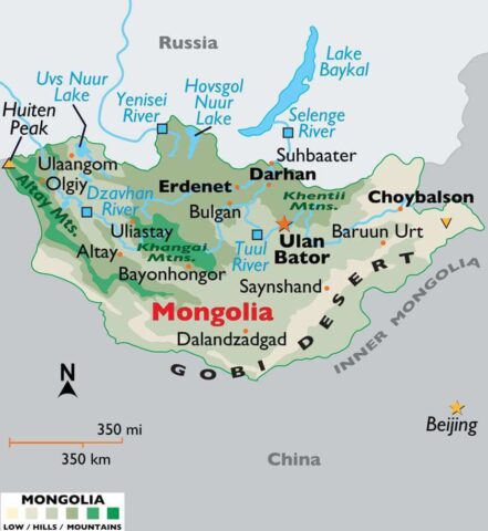 |
| 111 | Montenegro | 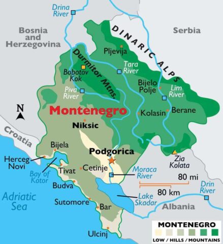 |
| 112 | Morocco | 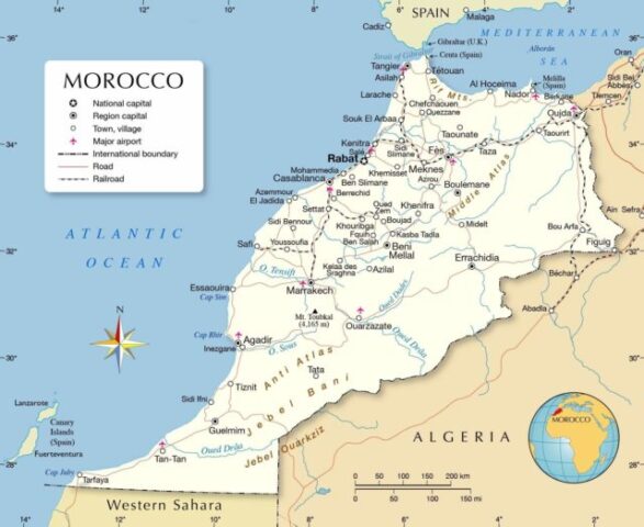 |
| 113 | Mozambique | 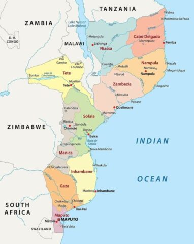 |
| 114 | Myanmar (Burma) | 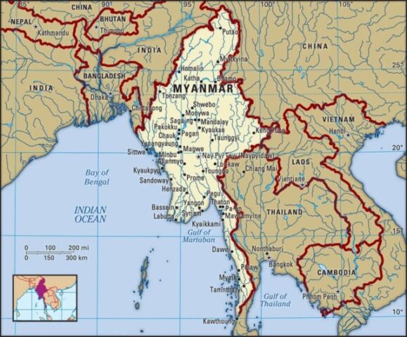 |
| 115 | Namibia | 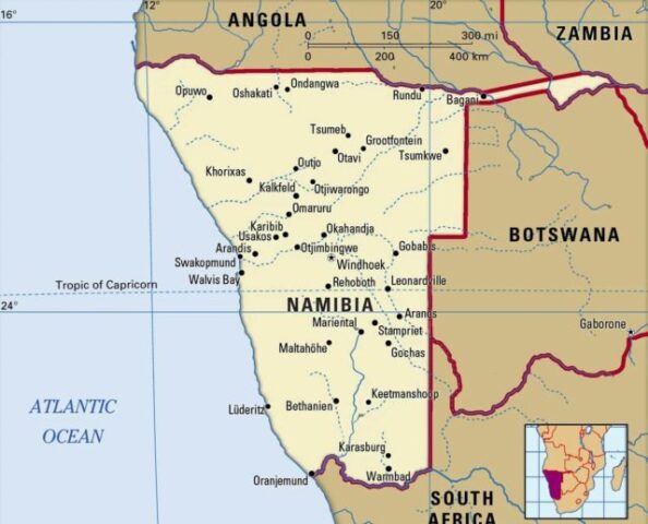 |
| 116 | Nauru | 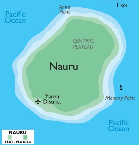 |
| 117 | Nepal | 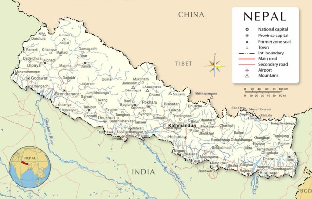 |
| 118 | Netherlands | 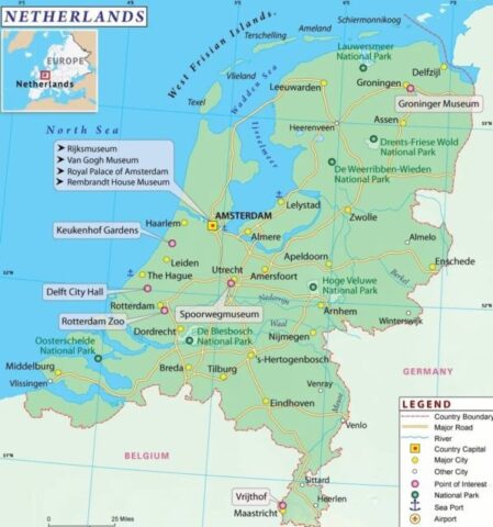 |
| 119 | New Zealand | 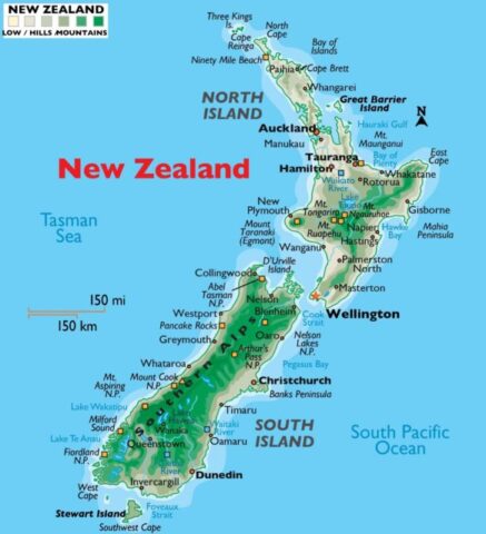 |
| 120 | Nicaragua | 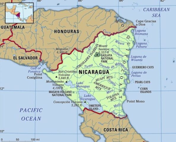 |
| 121 | Niger | 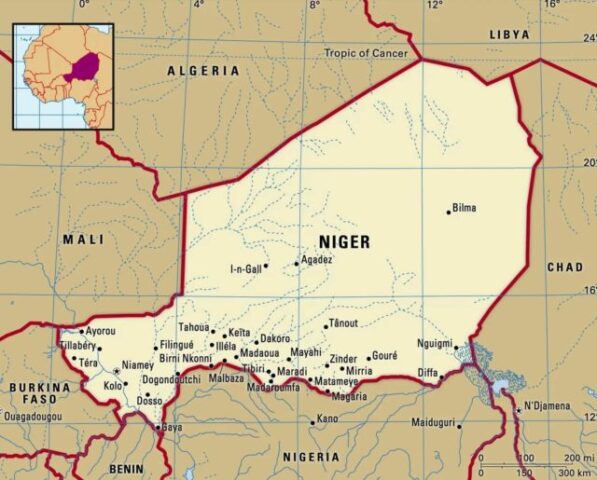 |
| 122 | Nigeria | 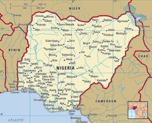 |
| 123 | North Korea | 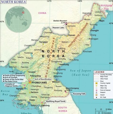 |
| 124 | Norway | 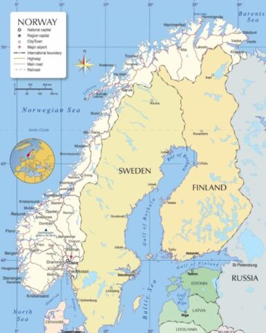 |
| 125 | Oman | 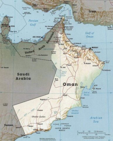 |
| 126 | Pakistan | 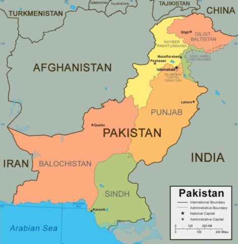 |
| 127 | Palau | 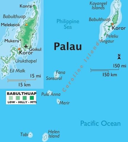 |
| 128 | Palestine | 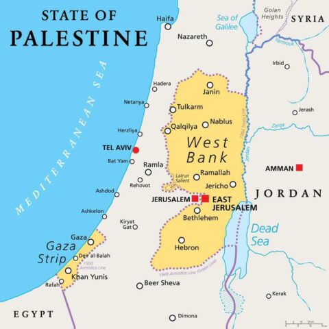 |
| 129 | Panama | 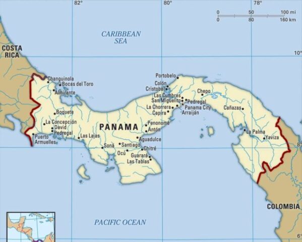 |
| 130 | Papua New Guinea | 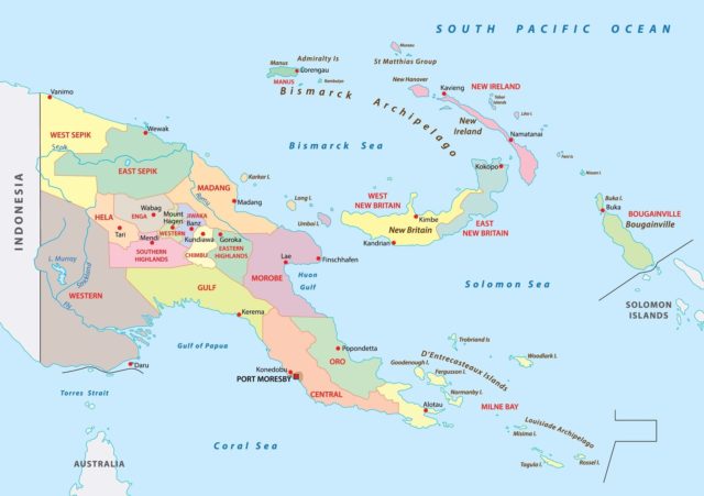 |
| 131 | Paraguay | 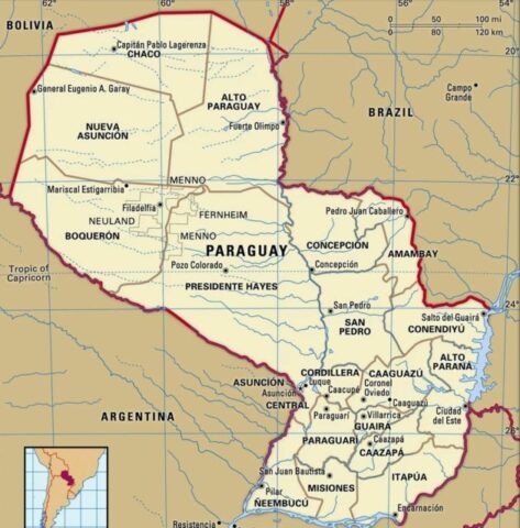 |
| 132 | Peru | 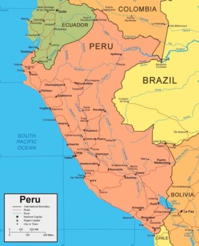 |
| 133 | Philippines | 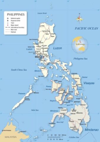 |
| 134 | Poland | 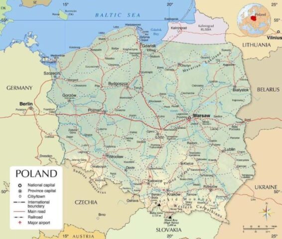 |
| 135 | Portugal | 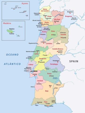 |
| 136 | Qatar | 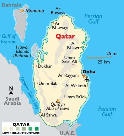 |
| 137 | Republic of the Congo | 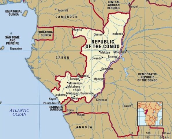 |
| 138 | Romania | 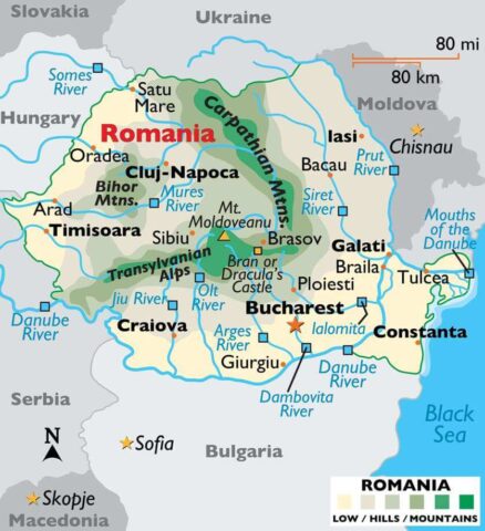 |
| 139 | Russia | 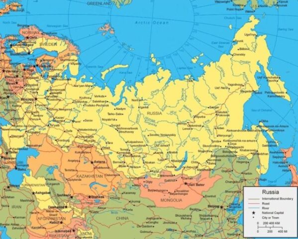 |
| 140 | Rwanda | 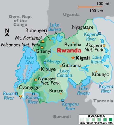 |
| 141 | Saint Kitts & Nevis | 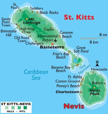 |
| 142 | Saint Lucia | 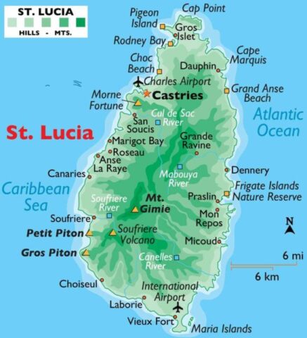 |
| 143 | Saint Vincent & The Grenadines | 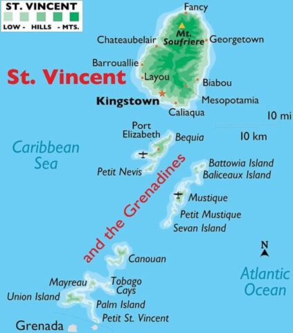 |
| 144 | Samoa | 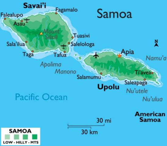 |
| 145 | San Marino | 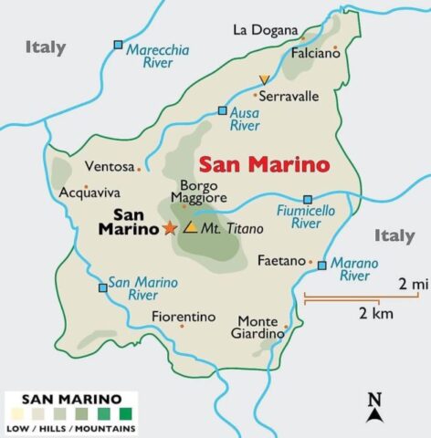 |
| 146 | Sao Tome & Principe | 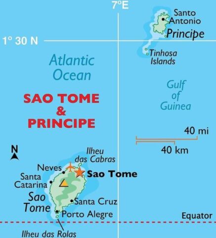 |
| 147 | Saudi Arabia | 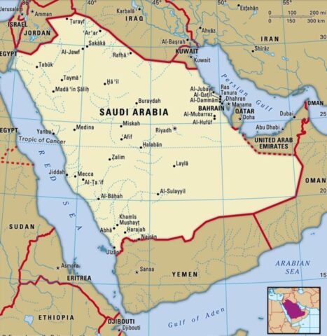 |
| 148 | Senegal | 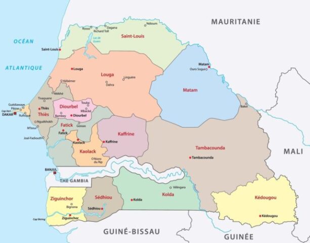 |
| 149 | Serbia | 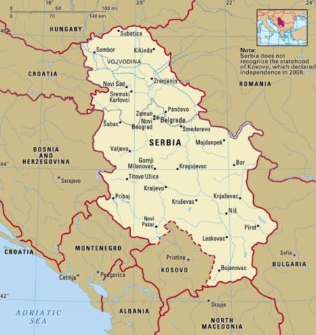 |
| 150 | Seychelles | 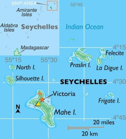 |
| 151 | Sierra Leone | 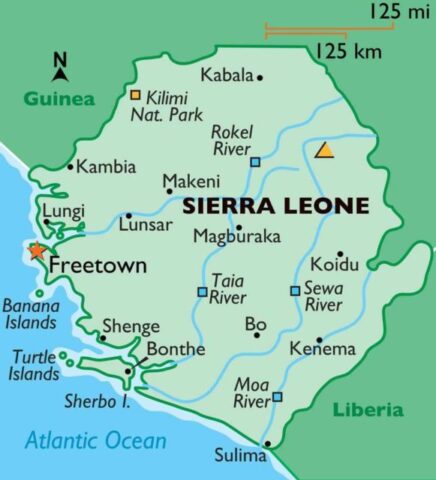 |
| 152 | Singapore | 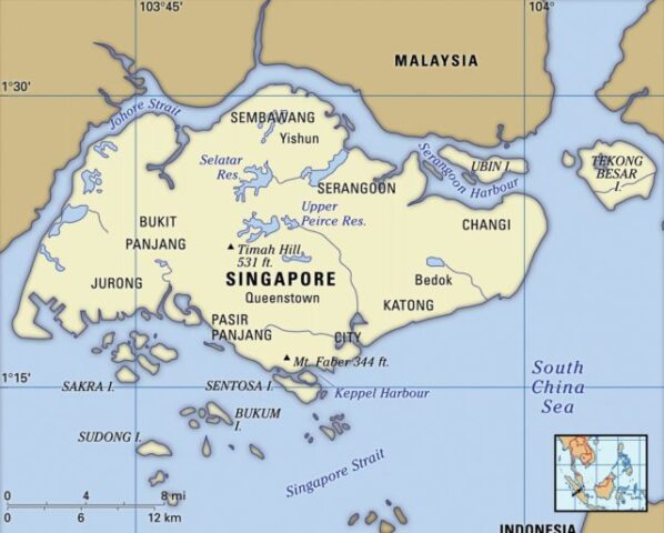 |
| 153 | Slovakia | 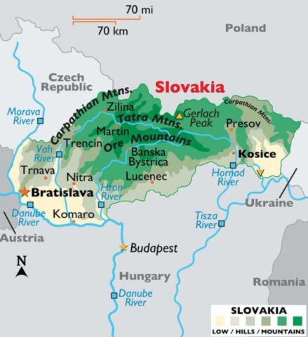 |
| 154 | Slovenia |  |
| 155 | Solomon Islands | 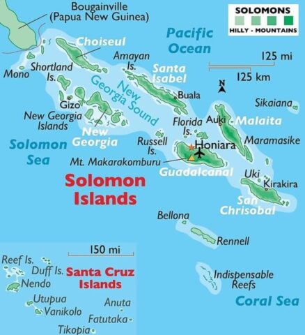 |
| 156 | Somalia | 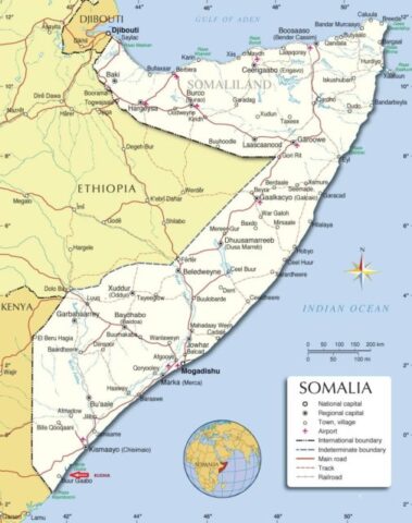 |
| 157 | South Africa | 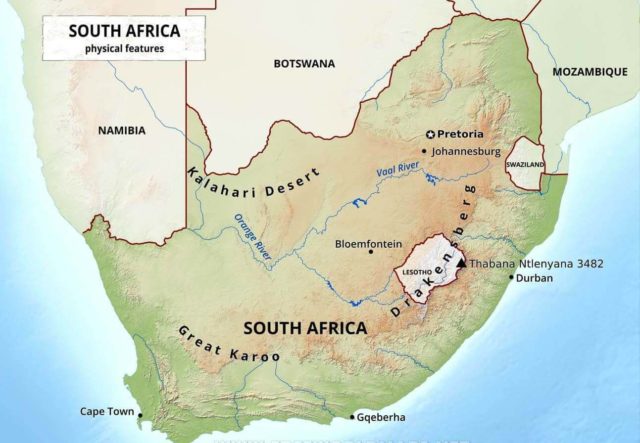 |
| 158 | South Korea | 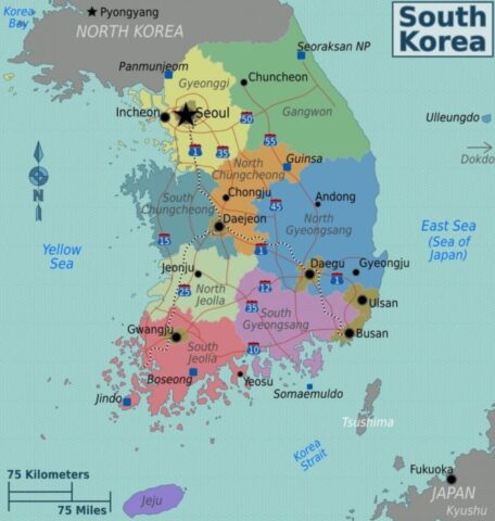 |
| 159 | South Sudan | 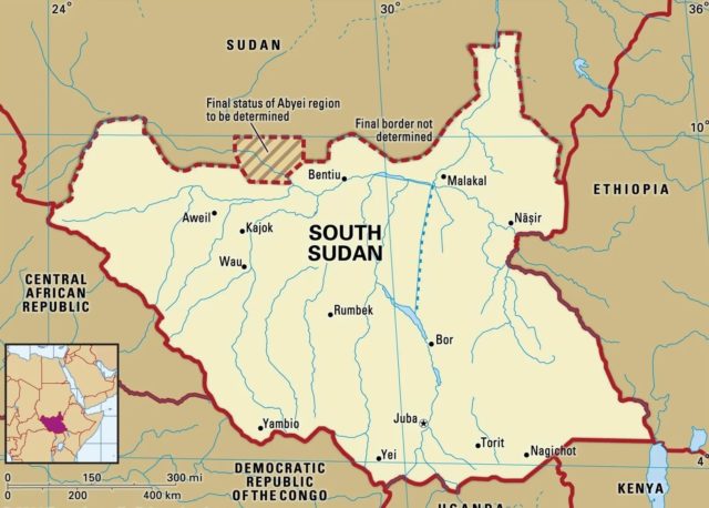 |
| 160 | Spain | 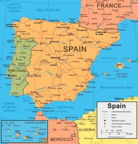 |
| 161 | Sri Lanka | 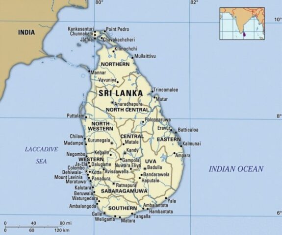 |
| 162 | Sudan | 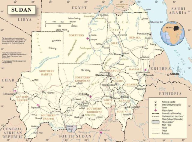 |
| 163 | Suriname | 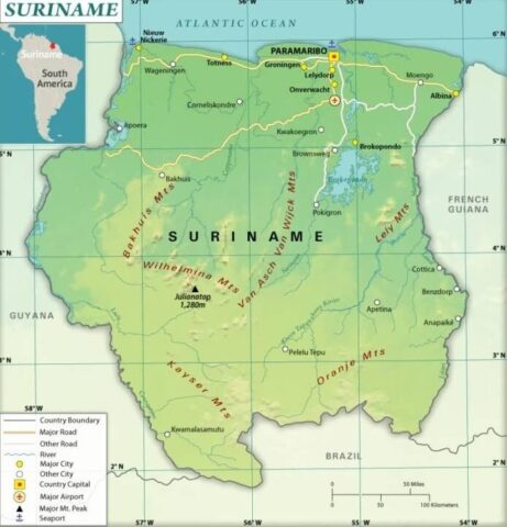 |
| 164 | Swaziland (Eswatini) | 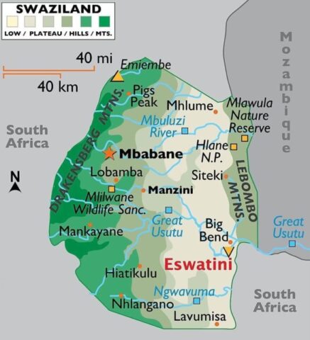 |
| 165 | Sweden | 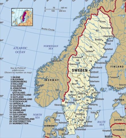 |
| 166 | Switzerland | 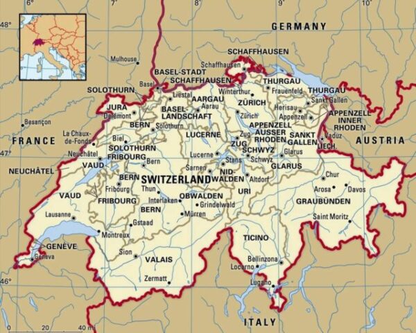 |
| 167 | Syria | 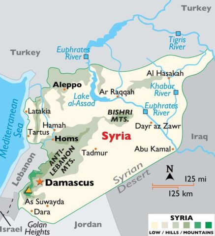 |
| 168 | Taiwan | 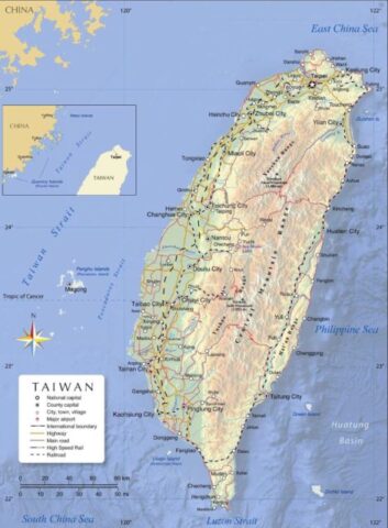 |
| 169 | Tajikistan | 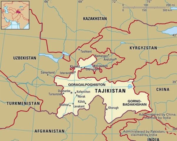 |
| 170 | Tanzania | 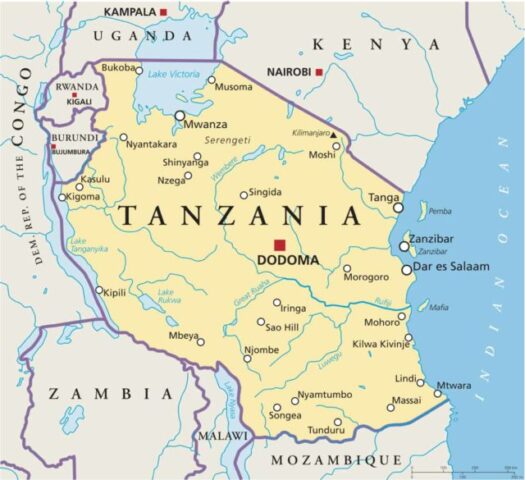 |
| 171 | Thailand | 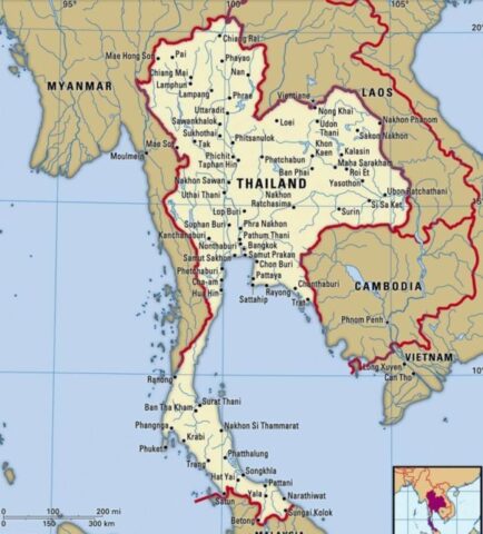 |
| 172 | The Bahamas | 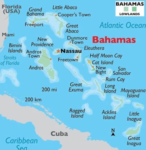 |
| 173 | The Gambia | 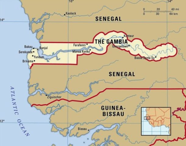 |
| 174 | Timor-Leste (East Timor) | 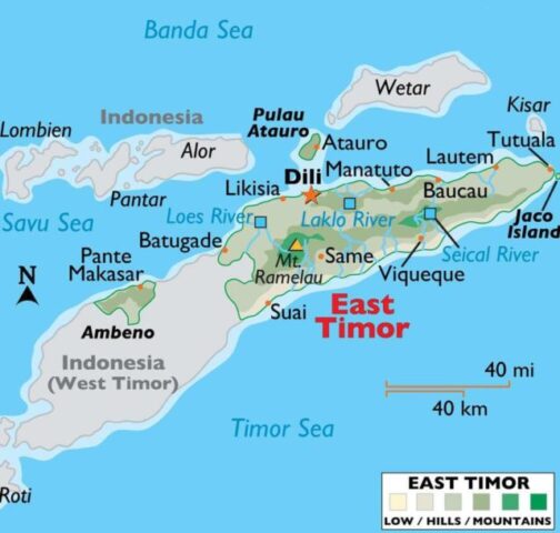 |
| 175 | Togo | 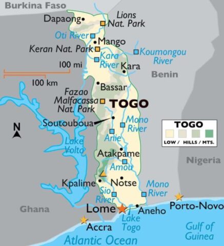 |
| 176 | Tonga | 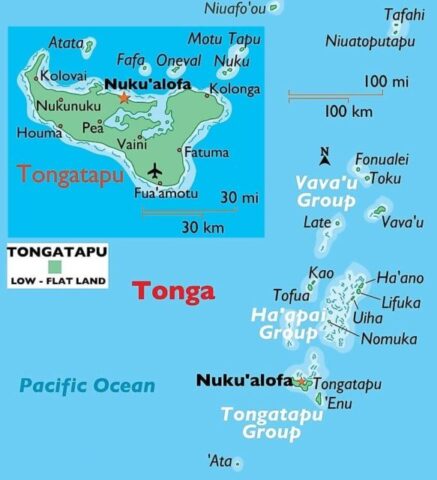 |
| 177 | Trinidad & Tobago | 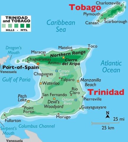 |
| 178 | Tunisia | 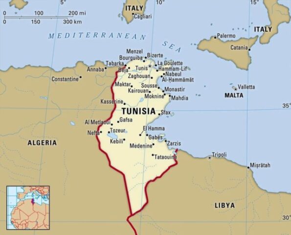 |
| 179 | Turkey | 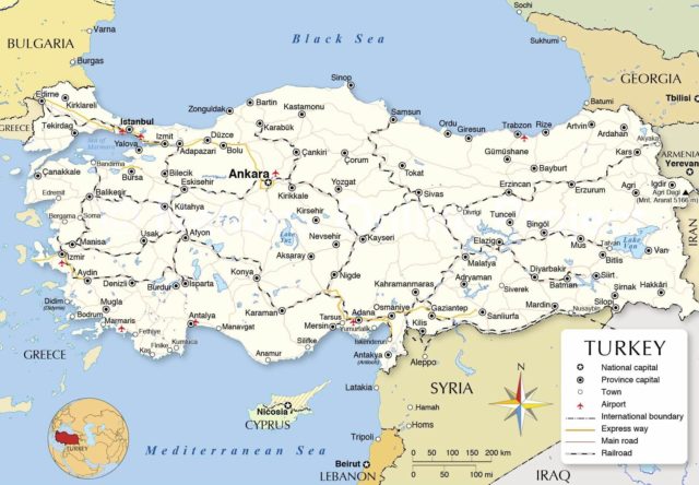 |
| 180 | Turkmenistan | 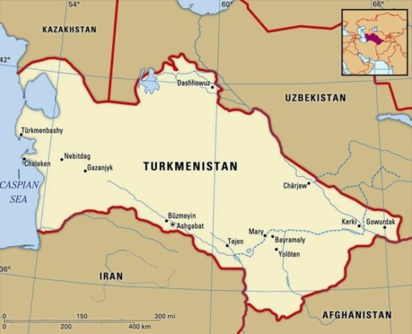 |
| 181 | Tuvalu | 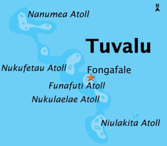 |
| 182 | Uganda | 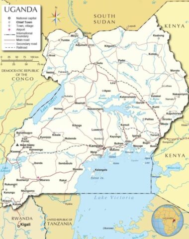 |
| 183 | Ukraine | 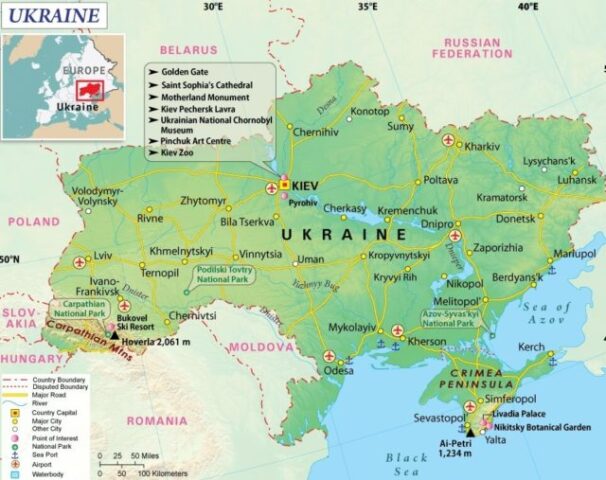 |
| 184 | United Arab Emirates (UAE) | 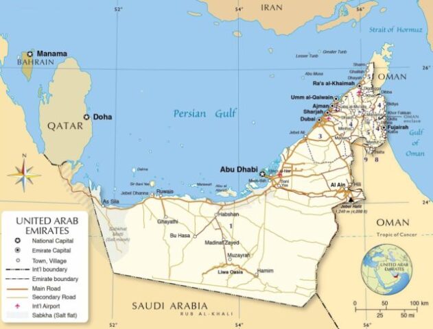 |
| 185 | United Kingdom (UK) | 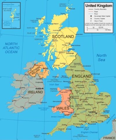 |
| 186 | United States of America (USA) | 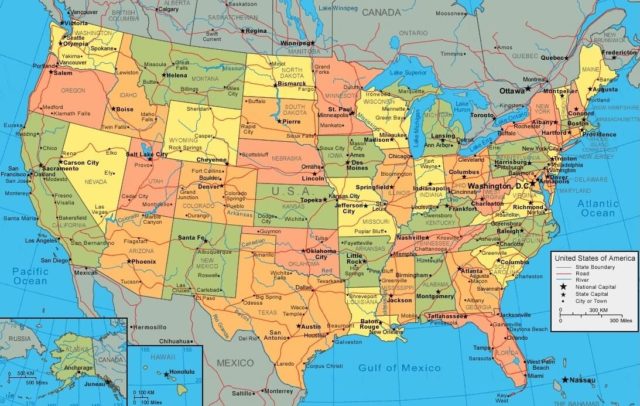 |
| 187 | Uruguay | 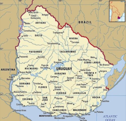 |
| 188 | Uzbekistan | 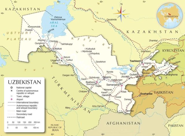 |
| 189 | Vanuatu | 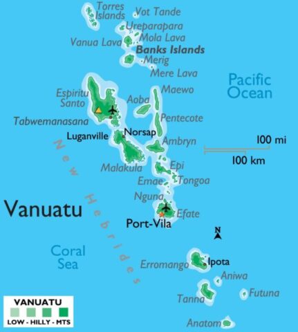 |
| 190 | Vatican City (Holy See) | 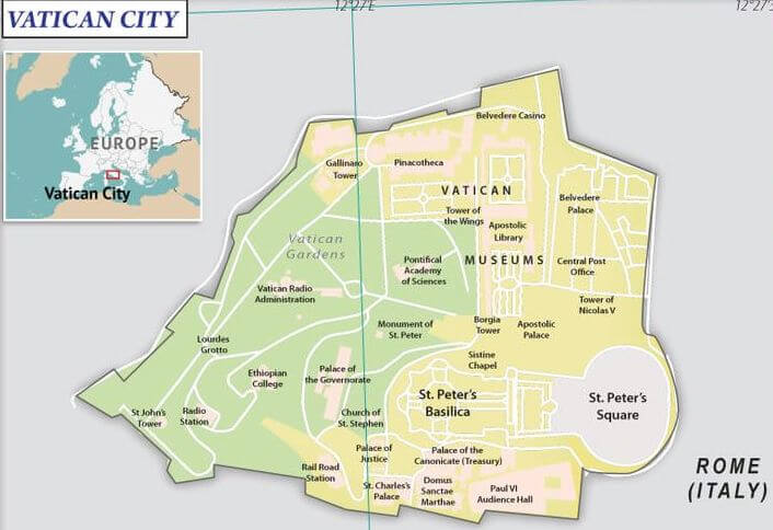 |
| 191 | Venezuela | 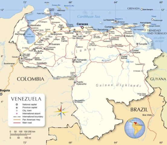 |
| 192 | Vietnam | 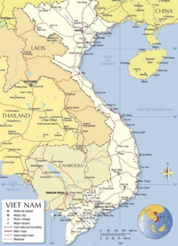 |
| 193 | Yemen | 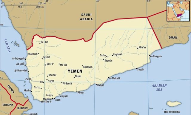 |
| 194 | Zambia | 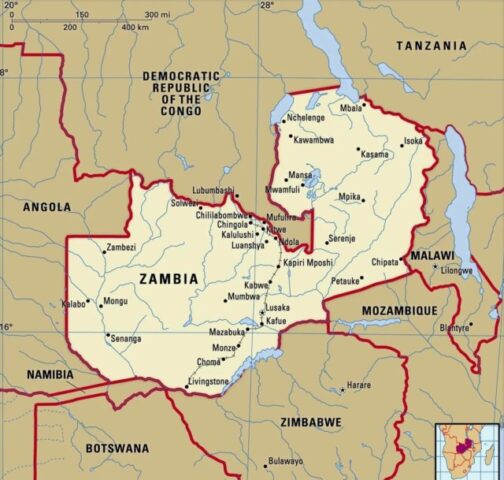 |
| 195 | Zimbabwe | 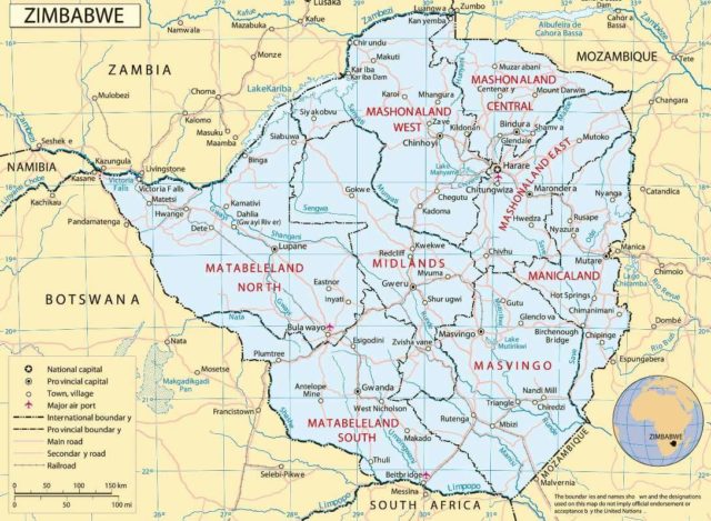 |
In Google maps, all information is available about each country. There are also quizzes to test your knowledge and learn about geography. You can also use these resources to improve your knowledge and learn more about the history of the various countries. It is possible to download free versions of the maps of all countries on Google Maps.
A political map of Europe will show the capitals of all the member states of the European Union. Maps of all countries can be viewed online, and there are many different types. You can also view a map of the Black Sea Region, the Baltic Sea, and the Iberian Peninsula.
Maps of all countries in the World can help you improve your knowledge of each country. A map of all countries is helpful for students as well as professionals. This website features a variety of maps for different purposes. For example, you can view maps of all countries on a single page or a few different pages, or you can find a country map of all countries on our website. Alternatively, you can download a copy of a national map and print it out if you prefer.
Types of Maps in the world
There are two types of world maps. The first type of map is a political map of all countries. It displays the different territorial borders of countries. The second type of map is a physical one. The latter is made to show the geographical features of a country, such as its climate and land. It can also include information on the type of soil and vegetation.
You can also find a searchable map of the world on the App Store. By analyzing these statistics, you can easily find out whether your application is popular and attracts users from all over the world.
If you are looking for maps of all countries, you can look at a political world map that includes the countries. You can also find a map of the South China Sea, which shows the bordering countries of China. The map of the Solar System can show planets, asteroids, and stars. You can also check out a world map that shows the underlying rock beneath the surface of the earth.
You can also download free maps of all countries on the App Store. These maps are available for both Android and iOS. You can search for specific country names and then download them. The United States has the highest download rank, while Australia and Canada have the highest download counts.
The United States is a huge country, with a number of states. In addition to these, it also has territories, including Hong Kong, Taiwan, and Myanmar. Maps of all countries can be used as references for a variety of purposes. They can also be printed out for school children.
Maps of all countries
You can also use a map of the world to learn about different regions and countries. There are many other countries on these maps. There are many more maps to browse. You can even search for specific regions of interest. Maps of all countries are available for the United States, India, and China.
The political map of the world will show the member states of the European Union and their capital cities. You can also look at a map of the world that will show the countries’ border areas. It will also show the borders between the United States and Canada. This kind of map is the most popular for studying different areas. When you use a global map, you can zoom in and out of it at any time.
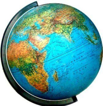
It is important to know how many states you have when you’re studying a country’s geography. A political map of the world focuses on political features. These maps usually highlight the territorial boundaries of countries and emphasize human settlement. A physical map will show the geographical features of each country, including the land use and the underlying rock. The political and social aspects of a world map are the main focus of a physical map.
- Please check the following link to check all countries with flags in the world.
- Please check the following link to check all countries with capitals in the world.
- Please check the following link to check the currency of all countries in the world.
- Please check the following link to check the currency symbols of all countries in the world.
- Please check the following link to check the all countries currency codes list in the world.
