The Galapagos Islands are an archipelago of volcanic islands, which was located on either side of the equator in the Pacific Ocean. They are situated in the center of the Western Hemisphere. In this topic we covered major information about Galapagos Islands.
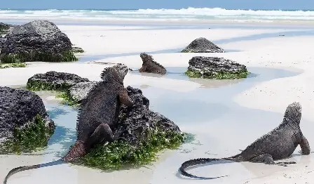
The Galapagos Islands, located 906 km (563 mi) west of the mainland, are part of the Republic of Ecuador. These islands are known for their many endemic species, and they were studied by Charles Darwin during the second voyage of the HMS Beagle.
Darwin’s observations and collections contributed to the development of his theory of evolution through natural selection. The Galapagos Islands and their surrounding waters form the Galapagos Province of Ecuador, as well as the Galapagos National Park and the Galapagos Marine Reserve.
The first recorded visit to the islands occurred in 1535. Fray Tomas de Berlanga, the Bishop of Panama foot upon the undiscovered land while on a voyage to Peru to mediate a dispute between the Spanish conquistadors Francisco Pizarro and Diego de Almagro.
Tomas de Berlanga eventually returned to the Spanish Empire. He described the islands, which were later named insular de los Galapagos, or the Island of Tortoises, on the Abraham Ortelius map of Americae Sive Novi Orbis published in 1570.
The first crude map of the about Galapagos Islands was made in 1684 by the buccaneer Ambrose Cowley. He named the individual islands after some of his fellow pirates or after noblemen and English royalty.
Those names were used in authoritative navigation charts of the islands that were prepared during the Beagle survey, led by Captain Robert Fitzroy, and in Darwin’s popular book, The Voyage of the Beagle.
The Galapagos Islands were taken from Spanish ownership by the newly independent Republic of Ecuador in 1832. Later, the islands were given new Spanish names. Although the older names continued to be used in English language publications, such as Herman Melville’s The Encantadas, published in 1854.
The Galapagos Islands constitute one of the provinces of Ecuador. They made up of 3 cantons named after the most populous islands. Those names are San Cristobal, Isabela, and Santa Cruz.
The Galapagos Islands are located on the equator. Periodically, the weather is influenced by El Nino events. It occur roughly every 3 to 7 years and are characterized by warm sea surface temperatures, a rise in sea level, increased wave action, and a depletion of nutrients in the water.
During the June to November season, the temperature by the sea reached up to 220C (720F). The steady, cold wind blew from the south and southeast, often accompanied by drizzles and dense fog that obscured the islands.
The weather changed with altitude, with temperatures decreasing and precipitation increasing as moisture in the clouds is released on the slopes of the large islands.
The Galapagos Islands were accessible via two airports: San Cristobal (San Cristobal Airport) and Baltra (Seymour Airport). Private aircraft were required to use Baltra, because it had overnight plane accommodations.
Land-based hotels were available on the inhabited islands of San Cristobal, Floreana, Santa Cruz, and Isabela.
More than half of the visitors of Galapagos Islands take tours using day boats and small hotels. There were only 116 visitor sites in the Galapagos, including 54 land sites and 62 scuba diving or snorkeling sites. Small groups were allowed to visit in shifts of 2 to 4 hours to limit the impact on the area. All groups were accompanied by licensed guides.